Property Record
3685 S Houston Levee Rd, Memphis, TN 38125


NEARBY LISTINGS FOR SALE OR LEASE
Property Detail
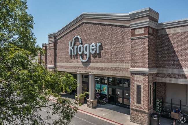
3685 S Houston Levee Rd
C0-243-0-0570
Gallina Centro Pd
Supermarket
NS WINCHESTER ROAD SEE MAP 201H
X
Shelby
47157C0490G
Tennessee
0
7.17 AC
2025
Germantown
021745
Memphis
59,664 SF
Memphis, TN-MS-AR
DEMOGRAPHICS near 3685 S Houston Levee Rd
1 Mile
3 Mile
5 Mile
2024 Total Population
2,698
34,156
105,323
2029 Population
2,665
33,570
102,809
Pop Growth 2024-2029
(1.22%)
(1.72%)
(2.39%)
Average Age
40
40
40
2024 Total Households
995
13,166
39,373
HH Growth 2024-2029
(1.41%)
(1.75%)
(2.43%)
Median Household Inc
$147,262
$126,100
$115,026
Avg Household Size
2.70
2.60
2.60
2024 Avg HH Vehicles
2.00
2.00
2.00
Median Home Value
$432,098
$440,419
$372,403
Median Year Built
1998
1999
1994
Nearby Places
Map Layers
Map Styles
 Street
 Aerial
- Restaurants
- Banks
- Shops
- Fitness
- Groceries
PUBLIC TRANSPORTATION
AIRPORT
Memphis International
DRIVE
WALK
Distance
Memphis International
26 min
15.0 mi
Freight Ports
Port of Shreveport
DRIVE
WALK
Distance
Port of Shreveport
429 min
388.8 mi
Nearby Properties
Address
Land Use
TOTAL SIZE
Lot Size
Zoning
Address
Land Use
TOTAL SIZE
Lot Size
Zoning
221,465 SF
63.45 AC
R-3
Address
Land Use
TOTAL SIZE
Lot Size
Zoning
103,960 SF
47.52 AC
R-3
Address
Land Use
TOTAL SIZE
Lot Size
Zoning
468,574 SF
8.30 AC
GC
Address
Land Use
TOTAL SIZE
Lot Size
Zoning
88,989 SF
6.91 AC
PD
Address
Land Use
TOTAL SIZE
Lot Size
Zoning
60,992 SF
12 AC
MPO
Address
Land Use
TOTAL SIZE
Lot Size
Zoning
56,237 SF
20.51 AC
CA
Address
Land Use
TOTAL SIZE
Lot Size
Zoning
55,888 SF
44.01 AC
CA
Address
Land Use
TOTAL SIZE
Lot Size
Zoning
160,832 SF
19.89 AC
CA
Address
Land Use
TOTAL SIZE
Lot Size
Zoning
164,074 SF
14.18 AC
CA
Address
Land Use
TOTAL SIZE
Lot Size
Zoning
252,092 SF
13.77 AC
GC
Address
Land Use
TOTAL SIZE
Lot Size
Zoning
70,030 SF
8.03 AC
GC
Address
Land Use
TOTAL SIZE
Lot Size
Zoning
62,013 SF
20 AC
CA
Address
Land Use
TOTAL SIZE
Lot Size
Zoning
81,518 SF
4.22 AC
R-3
Address
Land Use
TOTAL SIZE
Lot Size
Zoning
251,597 SF
26.90 AC
EMP
Address
Land Use
TOTAL SIZE
Lot Size
Zoning
115,753 SF
21.54 AC
R-1
Address
Land Use
TOTAL SIZE
Lot Size
Zoning
40,257 SF
24.68 AC
R-1
Address
Land Use
TOTAL SIZE
Lot Size
Zoning
117,381 SF
27.16 AC
RU-2
Address
Land Use
TOTAL SIZE
Lot Size
Zoning
167,121 SF
13.56 AC
AG
Address
Land Use
TOTAL SIZE
Lot Size
Zoning
28,280 SF
3.47 AC
R-1
Address
Land Use
TOTAL SIZE
Lot Size
Zoning
67,592 SF
18.31 AC
PD
Address
Land Use
TOTAL SIZE
Lot Size
Zoning
70,038 SF
17.95 AC
CA
Address
Land Use
TOTAL SIZE
Lot Size
Zoning
95,023 SF
33.86 AC
O-51
Address
Land Use
TOTAL SIZE
Lot Size
Zoning
813,591 SF
37.02 AC
EMP
Address
Land Use
TOTAL SIZE
Lot Size
Zoning
223,103 SF
19.25 AC
SCC
Address
Land Use
TOTAL SIZE
Lot Size
Zoning
144,416 SF
19.29 AC
SC-1
Address
Land Use
TOTAL SIZE
Lot Size
Zoning
71,363 SF
10 AC
R-T
Address
Land Use
TOTAL SIZE
Lot Size
Zoning
65,713 SF
29.06 AC
R-3
Address
Land Use
TOTAL SIZE
Lot Size
Zoning
17,812 SF
25 AC
R-3
Address
Land Use
TOTAL SIZE
Lot Size
Zoning
107,938 SF
9.16 AC
CA
Address
Land Use
TOTAL SIZE
Lot Size
Zoning
16,655 SF
5.69 AC
SCC
The World's #1 Commercial Real Estate Marketplace
Connect with us
© 2026 CoStar Group
The information above has been obtained from sources believed reliable. While we do not doubt its accuracy we have not verified it and make no guarantee, warranty or representation about it. It is your responsibility to independently confirm its accuracy and completeness. Any projections, opinions, assumptions, or estimates used are for example only and do not represent the current or future performance of the property. The value of this transaction to you depends on tax and other factors which should be evaluated by your tax, financial, and legal advisors. You and your advisors should conduct a careful, independent investigation of the property to determine to your satisfaction the suitability of the property for your needs.